

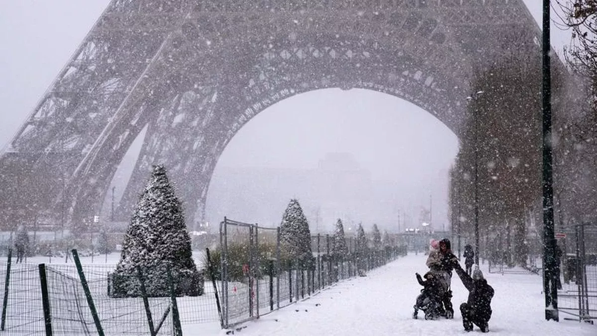
If anyone still hoped February would gracefully yield to spring in Lithuania, weather forecasts are shattering those illusions. In the coming days, a classic “February trap” situation is forming, where a brief thaw is followed by a clear but biting high-pressure system, and then moisture-laden cyclones bring sleet, freezing rain, and black ice. Meteorologists openly warn: the most dangerous phase of winter is just beginning, with challenges not only from the cold but also from drastic temperature swings.
Currently, atmospheric processes over Europe are positioning the Baltic states at the epicenter of contrasts. A dry, cold anticyclone named Emmeram is strengthening from the north and northeast, and will expand over Lithuania starting Sunday. This means clear skies, light winds, and rapid nighttime cooling. However, Western Europe is simultaneously experiencing a strengthening Atlantic cyclone system, which will push warmer, more humid air towards the Baltics in the latter half of the week. The danger lies precisely at the confluence of these two forces.
Forecasters emphasize: Lithuania will first be locked in by frost, and then, within just a few days, the situation will change dramatically. Mixed precipitation falling on frozen ground will create ideal conditions for freezing rain, posing a serious threat to traffic, power grids, and pedestrians. This is one of winter’s most dangerous phenomena, often causing chaos even with minimal snowfall.
How Weather Will Change in Lithuania in the Coming Days
Sunday, February 8th: A Cold Overture
On Sunday night, an atmospheric front near southern Lithuania might bring a little snow, mainly to southern and southwestern regions. Further north, precipitation will be light, and in some places, “ice needles” – sparkling ice crystals formed in colder temperatures – may appear. By day, snowfall will cease, and the sky will clear. Winds will be from the northeast, 7–12 m/s, more noticeable in western areas. Nighttime temperatures will drop to –10…–14°C, slightly milder in the south at –6…–9°C. Daytime temperatures will hover around –6…–11°C. This is just the prelude to more severe frost.
Monday, February 9th: The Anticyclone Takes Hold
Lithuania will be fully enveloped by the anticyclone. No precipitation is expected, but fog will form in many places overnight and in the morning, with heavy frost covering the surface. Winds will be light. Nighttime temperatures will fall to –12…–17°C, and in northeastern and eastern regions, up to –18…–23°C. Daytime will not be warmer, remaining at –8…–13°C. This is already dangerous cold, especially for those without shelter and for drivers.
Tuesday, February 10th: Frost Peaks
The frost will reach its peak on Tuesday. Most areas will remain clear, with fog and frost persisting. In the late afternoon, light snow might fall in southern and southeastern regions, but precipitation will be minimal. Nighttime temperatures will drop to –19…–24°C, with western and coastal areas being slightly milder at –13…–18°C. Daytime will stay around –9…–14°C. This will be the week’s coldest day, demanding extreme caution.
Wednesday, February 11th: The First Signs of a Shift
The weather will begin to show the first signs of a turnaround. Overnight and in the morning, snow might fall in southern, southeastern, and eastern regions, but will ease during the day. Nighttime temperatures will range from –8 to –13°C, though in western and northwestern areas, they could drop to –14…–18°C, and still reach –20°C in the northeast. Daytime will warm to –3…–8°C, with eastern regions remaining colder at –9…–13°C.
Thursday, February 12th: The Most Dangerous Phase Begins
The most dangerous phase will commence on Thursday. The night will still be without significant precipitation, but moisture-laden weather will arrive during the day. While snow will still fall in many places, in the southwest and south, it will begin to mix with sleet, drizzle, and light freezing rain. Nighttime temperatures will be –13…–18°C, –7…–12°C in southern regions. Daytime temperatures will rise to –1…–6°C. Dangerous ice will start forming on the frozen surface.
Friday, February 13th: Widespread Mixed Precipitation
Mixed precipitation will cover most of the country by Friday. Sleet and drizzle will turn into freezing rain in places, making roads and sidewalks extremely slippery. Nighttime temperatures will range from –1 to –6°C, with daytime temperatures hovering around 0°C. This will be one of the most dangerous days in terms of traffic conditions.
Saturday, February 14th: Lingering Ice
Sleet will dominate on Saturday, sometimes mixing with rain. Temperatures will be –1…+1°C, with slippery surfaces remaining. On Sunday, February 15th, the weather will change again, with snowfall increasing and winds shifting from the south. Nighttime temperatures will be –2…–6°C, and daytime 0…–2°C.
What Does This All Mean?
February is far from over in Lithuania. On the contrary, it’s preparing a treacherous combination: harsh frost, a sudden thaw, and dangerous freezing rain. Meteorologists stress that such situations often cause more problems than stable cold or continuous thawing. Therefore, in the coming days, it’s crucial to follow weather forecasts, plan travel cautiously, and not be misled by brief signs of warmth.
What are your strategies for dealing with these extreme winter conditions? Share your tips in the comments!